
Uncategorized files
Showing below up to 100 results in range #101 to #200.
 13.jpg 816 × 612; 114 KB
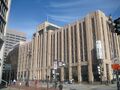
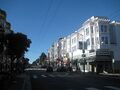
 1301-Mongtomery-Street 0107.jpg 720 × 531; 90 KB
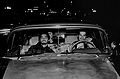
 1332798384-jorma002.jpg 288 × 629; 41 KB
 134-Golden-Gate.jpg 648 × 486; 138 KB
 1355 Market. 2023.JPG 640 × 480; 123 KB
 1355 Market. 2023.sharpened.jpg 640 × 480; 292 KB
 1355 Market Entrance. 2023.JPG 640 × 480; 108 KB
 1355 Market Entrance. 2023.sharpened.jpg 640 × 480; 251 KB
 1355 Market Entrance All the Way to Roof. 2023.JPG 480 × 640; 124 KB
 1355 Market Entrance All the Way to Roof. 2023.sharpened.JPG 480 × 640; 261 KB
 1378 McAllister Tanko.jpg 441 × 358; 32 KB
 13b-1499-masonic 4373.jpg 504 × 378; 118 KB
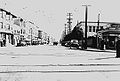
 13th and Duboce 1951 AAB-3408.jpg 870 × 400; 94 KB
 14-1526-masonic-maybeck 4370.jpg 504 × 378; 122 KB
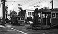
 14-Muni-car-near-Daly-City-outer-Mission-c-1920s.jpg 1,080 × 664; 184 KB
 14.gif 144 × 144; 2 KB
 1400x609-huey johnson 1970s.jpg 1,400 × 609; 91 KB
 1484 22nd Avenue.jpg 514 × 342; 185 KB
 14L-on-outer-MIssion 2796.jpg 800 × 501; 113 KB
 14 85292.gif 541 × 114; 12 KB
 14 Pacos-Tacos.jpg 800 × 528; 144 KB
 14 copy.JPG 750 × 503; 131 KB
 14superhpman trans.gif 259 × 432; 16 KB
 14th & Mission 1869 Muybridge wnp24.194a.jpg 1,000 × 846; 360 KB
 15-11-piedmont 4368.jpg 504 × 378; 140 KB
 15.gif 144 × 144; 2 KB
 157-Lobos-Street-might-be-double-quake-shacks 2829.jpg 720 × 480; 108 KB
 157 Wiley Mime-Troupe Pere-Ubu.jpg 240 × 302; 18 KB
 158 Wiley Mime-Troupe Soldier-trying-to-get-into-Lock.jpg 296 × 240; 22 KB
 1599 Sanchez Alices Restaurant.jpg 800 × 533; 83 KB
 15 I-Hotel.jpg 800 × 545; 170 KB
 15 copy.JPG 504 × 750; 142 KB
 15th betw. Folsom and Harrison 1927 AAB-5886.jpg 558 × 400; 57 KB
 16-1-july-4-1861-Union-Meeting.jpg 720 × 537; 115 KB
 16-2-Lincoln-riot.jpg 576 × 895; 158 KB
 16.gif 144 × 144; 2 KB
 16.jpg 2,000 × 1,312; 689 KB
 1600-BLock-of-Gough-1920s wnp14.jpg 720 × 426; 135 KB
 16th-St-1938.jpg 761 × 516; 117 KB
 16th-St-east-at-Church-1937-SFPL.jpg 1,080 × 731; 141 KB
 16th-and-Church-1947 72dpi.jpg 1,080 × 639; 174 KB
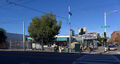 16th-and-Folsom-2014 P1080648.jpg 800 × 429; 105 KB
 16th-and-Folsom-Kilpatricks-store-after-closing-2014 P1080652.jpg 800 × 534; 79 KB
 16th & Alabama 1870 wnp71.2130.jpg 1,000 × 659; 205 KB
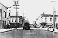
 16th and Shotwell circa 1904 looking west to South Van Ness wnp32.0307.jpg 1,000 × 582; 181 KB
 17&HARIS chuy-campusano-mural.jpg 720 × 551; 145 KB
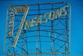
 17-reasons bw long view.jpg 528 × 357; 38 KB
 17.gif 144 × 144; 2 KB
 17.jpg 2,000 × 1,312; 654 KB
 1700 Haight.2023.JPG 640 × 480; 91 KB
 1700 Haight.2023.sharpened.jpg 640 × 480; 259 KB
 17 at sf media archive-mission local.jpg 720 × 480; 186 KB
 17reasons50.jpg 607 × 412; 74 KB
 17th-St-west-at-Sanchez-1928-SFPL.jpg 1,080 × 706; 177 KB
 17th-and-Folsom-Summer-2013 IMG 4072.jpg 720 × 540; 83 KB
 17th-and-Folsom-parking-lot-IMG 4069.jpg 720 × 540; 67 KB
 17th-and-Folsom P1080643.jpg 720 × 481; 110 KB
 17th-and-Mars-aug-1-2009 0882.jpg 720 × 540; 95 KB
 17th-and-Shotwell-P1070540.jpg 720 × 481; 84 KB
 18.gif 144 × 144; 2 KB
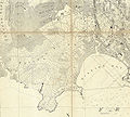
 1830-map-of-Mexican-Calif w-numbers.jpg 432 × 560; 93 KB
 1836-Palou 20210327 202706527.jpg 800 × 600; 203 KB
 1837-lithograph-of-Vioget-painting-of-Yerba-Buena.jpg 792 × 343; 64 KB
 1846-18641.jpg 885 × 683; 175 KB
 1849-Eddy-Re-Survey 2321001.jpg 792 × 1,017; 311 KB
 1849 Stockton Street AAB-5363.jpg 534 × 400; 57 KB
 1849 map of YB Cove and early SF.jpg 960 × 720; 70 KB
 1850 map with Rincon Point and original YB shoreline.jpg 1,890 × 887; 1.02 MB
 1850s view of Yerba Buena cove from north wnp37.02585.jpg 1,000 × 633; 324 KB
 1851-Dexter-Map-3.jpg 1,080 × 606; 206 KB
 1851-Dexter-Map-4.jpg 1,080 × 566; 201 KB
 1851-Dexter-Map-5.jpg 1,080 × 476; 170 KB
 1851-Dexter-Map-w-North-at-top.jpg 1,080 × 420; 108 KB
 1851-Dexter-map-2.jpg 1,080 × 461; 147 KB
 1851-YB-cove-with-Gordon-Vulcan-Foundry-at-lower-left.jpg 720 × 426; 102 KB
 1851-shoreline-and-jurisdiction-line-map.jpg 792 × 1,000; 414 KB
 1852-Britton-and-Rey-map.jpg 1,008 × 1,288; 766 KB
 1852-US-Coast-Survey-map-of-Mission-Bay-w-Mission-Plank-Road.jpg 720 × 642; 156 KB
 1852-William-Shew-daguerreotype-of-ships-in-YB-cove.jpg 792 × 557; 170 KB
 1852-mission-bay-map.jpg 720 × 672; 187 KB
 1853-Spring-Valley-Water-Co-map-of-SF.jpg 1,152 × 624; 257 KB
 1853 closeup on bog and swamps.jpg 1,920 × 1,230; 1.79 MB
 1853 pilings.jpg 1,920 × 1,145; 1.98 MB
 1854-Bixby-Bridgens-Map-w-Sparks-Claim.jpg 1,080 × 856; 412 KB
 1854 HF Bridgens map detail.JPG 792 × 594; 285 KB
 1855-celebration-of-success-in-Crimean-War-at-South-Park-A11.19.318n.jpg 720 × 751; 195 KB
 1856-bernal-tract.png 1,186 × 477; 518 KB
 1857-USCG-map-Monkey-Block.jpg 720 × 529; 224 KB
 1857-photo-map-tubbs-cord-walk.jpg 600 × 1,150; 219 KB
 1859-USGS-Coast-Survey-Map Potrero-Hill-Mission-Bay-East-Mission-excerpt.jpg 1,080 × 975; 438 KB
 1859-tubbs-cord-walk-ad.png 600 × 260; 104 KB


